Book of discoveries · 156
Geodetective: mapping 2
Zoom with the mouse wheel inside the image or use the buttons. Drag the enlarged image with the hand cursor; swipe to move on a touchscreen.
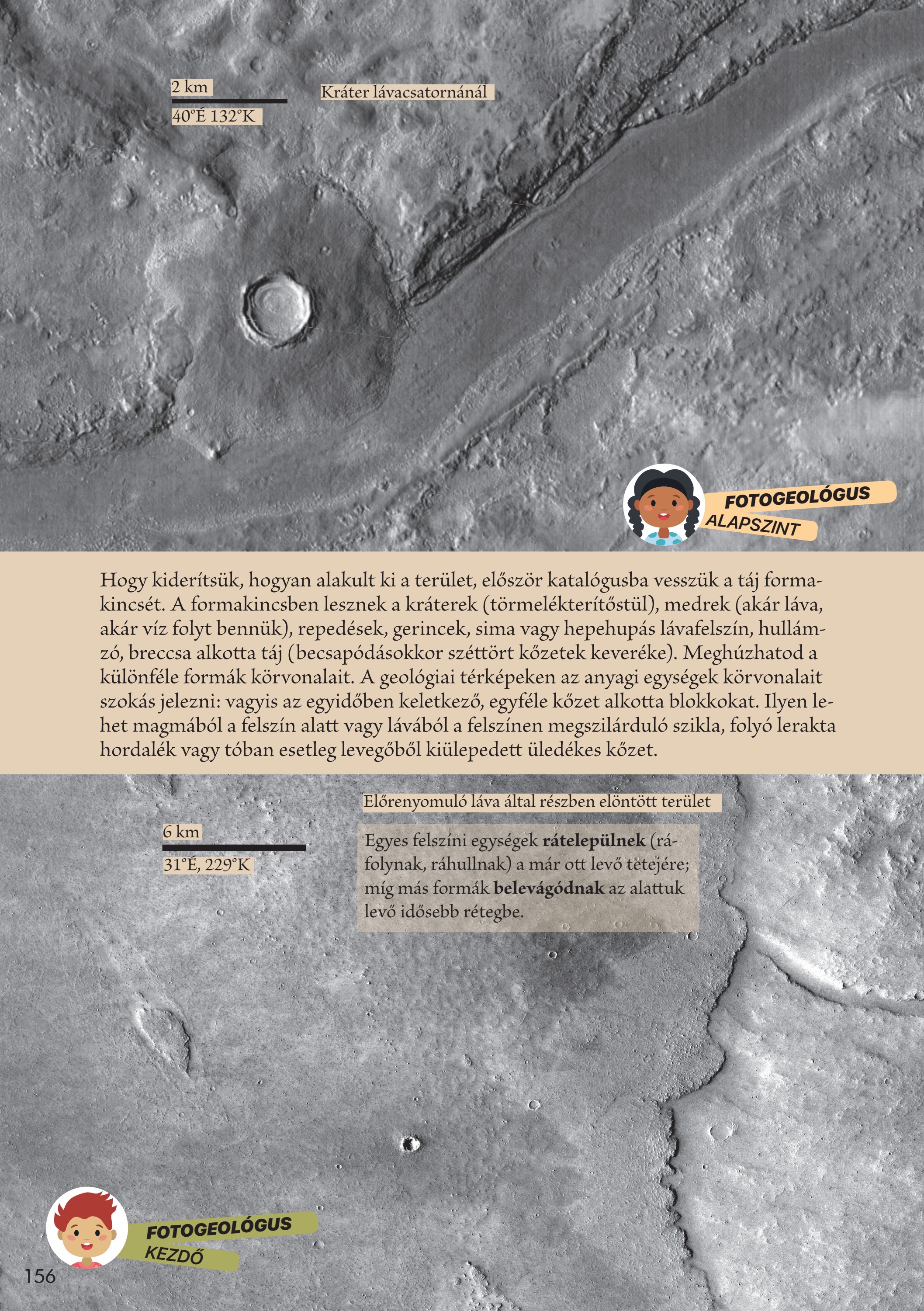
To discover how the region formed, first catalogue its landforms: craters with their ejecta, channels that carried lava or water, fractures, ridges, smooth or uneven lava surfaces, and undulating breccia terrain. You can outline these different forms. Geological maps normally outline material units: bodies of one rock type formed at the same time.
Some surface units are deposited, flow or fall onto pre-existing material, while other landforms cut into the older layer beneath.
Your observations
Your notes are saved in this browser.