Further publications by topic
Venus GIS and landform databases
Hargitai, H. I. (2026). The Venus index of places: Diversity of landforms, mapping equity, and the inclusion of derived data in an accessible tool. MAPSIT April 2026 Meeting (LPI Contribution No. 3151, Abstract No. 6020). Lunar and Planetary Institute.
This abstract explains how earlier maps and catalogues of Venusian landforms can be brought into a shared database. The unified index lets users compare data from different researchers and explore them through an accessible map. Source
Hargitai, H. I., Kereszturi, Á., & Vincze, M. (2025). V-GIS: A new Venus GIS with higher-order geologic feature layers and observation planning capabilities. Venus Exploration and Analysis Group (VEXAG) November 2025 Meeting (LPI Contribution No. 3122, Abstract No. 8001). Lunar and Planetary Institute.
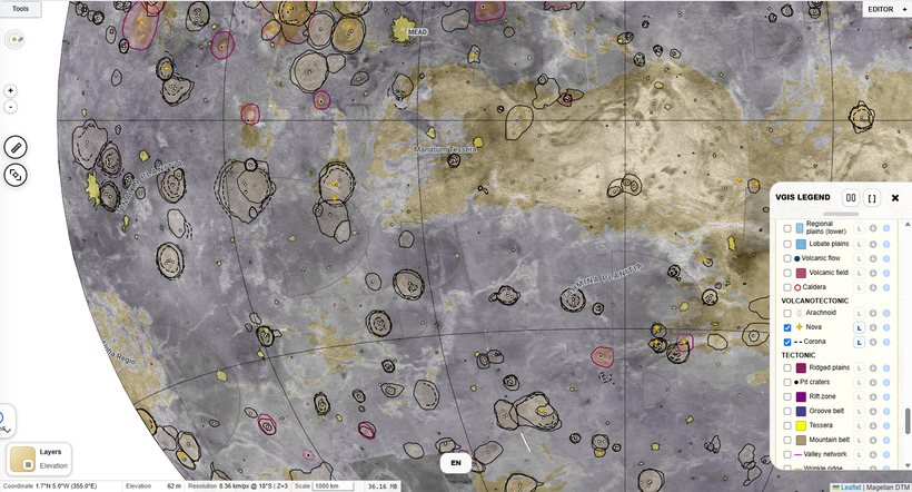
V-GIS brings maps and catalogues of Venusian surface features into a geographic information system. Comparing its different layers helps researchers understand the surface and plan observations for future spacecraft missions. Source
Hargitai, H., Szabó, D., Vincze, M., & Kereszturi, Á. (2025). An integrated, feature-based geographic information system for Venus. EPSC Abstracts, 18, EPSC-DPS2025-1305. EPSC-DPS Joint Meeting 2025. https://doi.org/10.5194/epsc-dps2025-1305
The researchers convert earlier catalogues of Venusian landforms into compatible map layers that can be overlaid and compared. This abstract presents the first year of development, including the cataloguing of spider-like and star-shaped volcanic-tectonic features. The data can support new research and spacecraft mission planning. Source
Further research
Helbert, J., Maturilli, A., D'Amore, M., Garcia-Munoz, A., Arnold, G., Haus, R., Csizmadia, S., & Hiesinger, H. (2018). Observing Venus with the MErcury Radiometer and Thermal infrared Imaging Spectrometer (MERTIS) During the Flybys of the ESA-JAXA Bepicolombo Spacecraft. LPSC, abstract #1338.
Vech, D., Szegő, K., Opitz, A., & Fraenz, M. (2014). Investigation of planetary space weather effects at Venus observed by the ASPERA-4 particle analyzer and the magnetometer flying onboard of Venus Express Mission. EGU, abstract #745.
Szegő, K., Dobe, Z., Márkusné Bebesi, Z., Coates, A., Földy, L., Fraenz, M., Opitz, A., & Vech, D. (2014). Ion heating near the ion composition boundary at Venus. EGU, abstract #2720.
Opitz, A., Witasse, O., Svedhem, H., Sauvaud, J., & Fedorov, A. (2013). Effects of the same CIR on the plasma environment of Venus, Earth and Mars. EPSC, abstract #EPSC2013-591.
Opitz, A., Witasse, O., Lester, M., Opgenoorth, H., Luhmann, J., Szegő, K., Andre, N., & Fedorov, A. (2013). Solar input at Venus and Mars during the 2012 conjunction. EGU, abstract #EGU2013-11096.
García, M. A., Hueso, R., Sanchez-Lavega, A., Markiewicz, W., Opitz, A., Witasse, O., & Titov, D. (2013). Venus Express/VMC observations of the Venus O2 visible nightglow. EGU, abstract #EGU2013-3334-3.