Book of discoveries · 153
Geodetective: mission planning
Zoom with the mouse wheel inside the image or use the buttons. Drag the enlarged image with the hand cursor; swipe to move on a touchscreen.
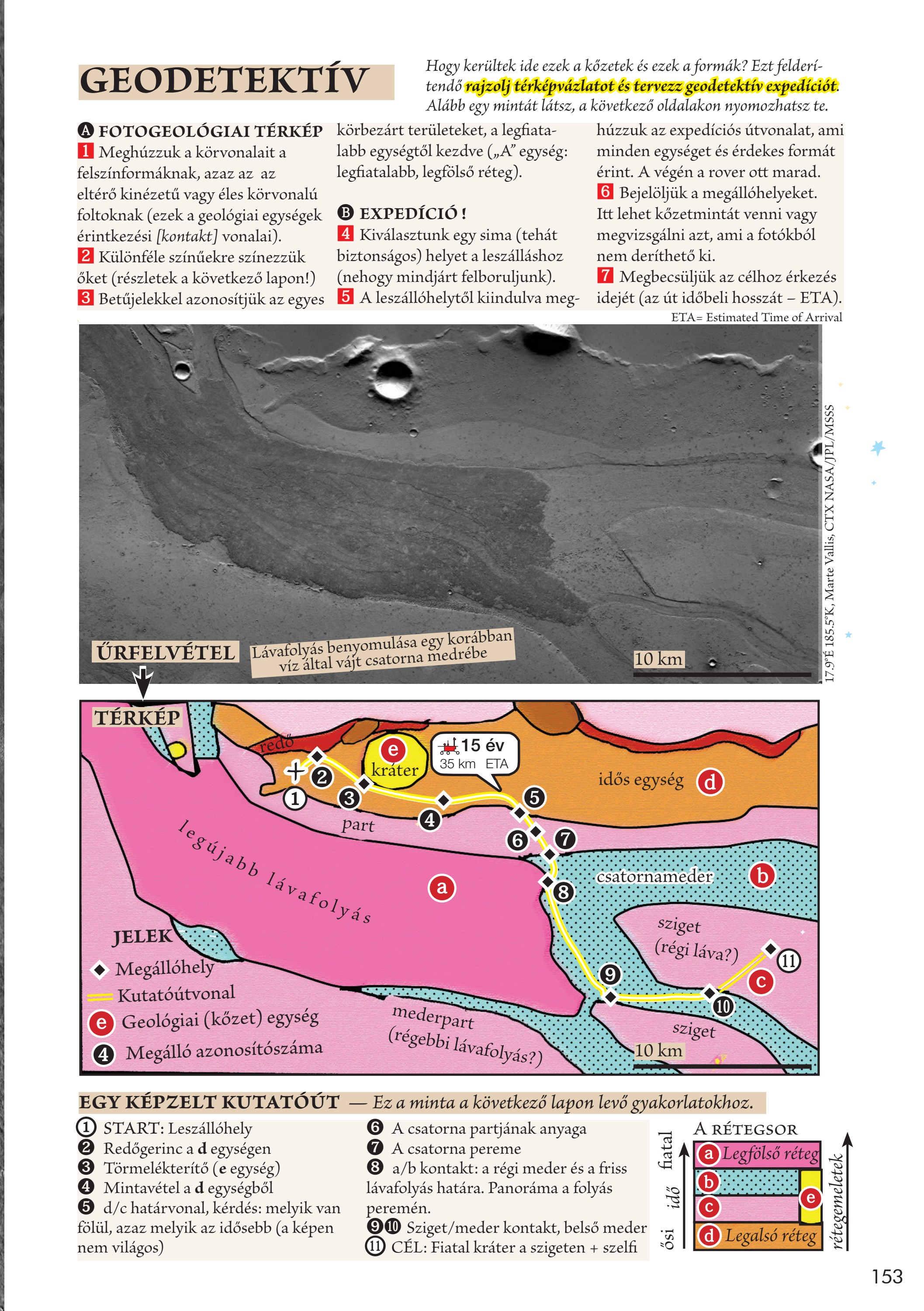
How did these rocks and landforms get here? To investigate, draw a sketch map and plan a geodetective expedition. Below is an example; on the following pages, you can investigate for yourself.
1 Outline the landforms: patches of different appearance or with sharp boundaries, marking contacts between geological units. 2 Colour them differently. 3 Identify each enclosed area with a letter, beginning with the youngest unit: unit A is the youngest, uppermost layer.
4 Choose a smooth, safe landing site. 5 Draw an expedition route from it that visits every unit and interesting landform. The rover stays at its final destination. 6 Mark the stops, where rock samples can be collected or questions not answered by photographs investigated. 7 Estimate the arrival time: ETA, Estimated Time of Arrival.
Your observations
Your notes are saved in this browser.