Atlas of Mars · 16–17
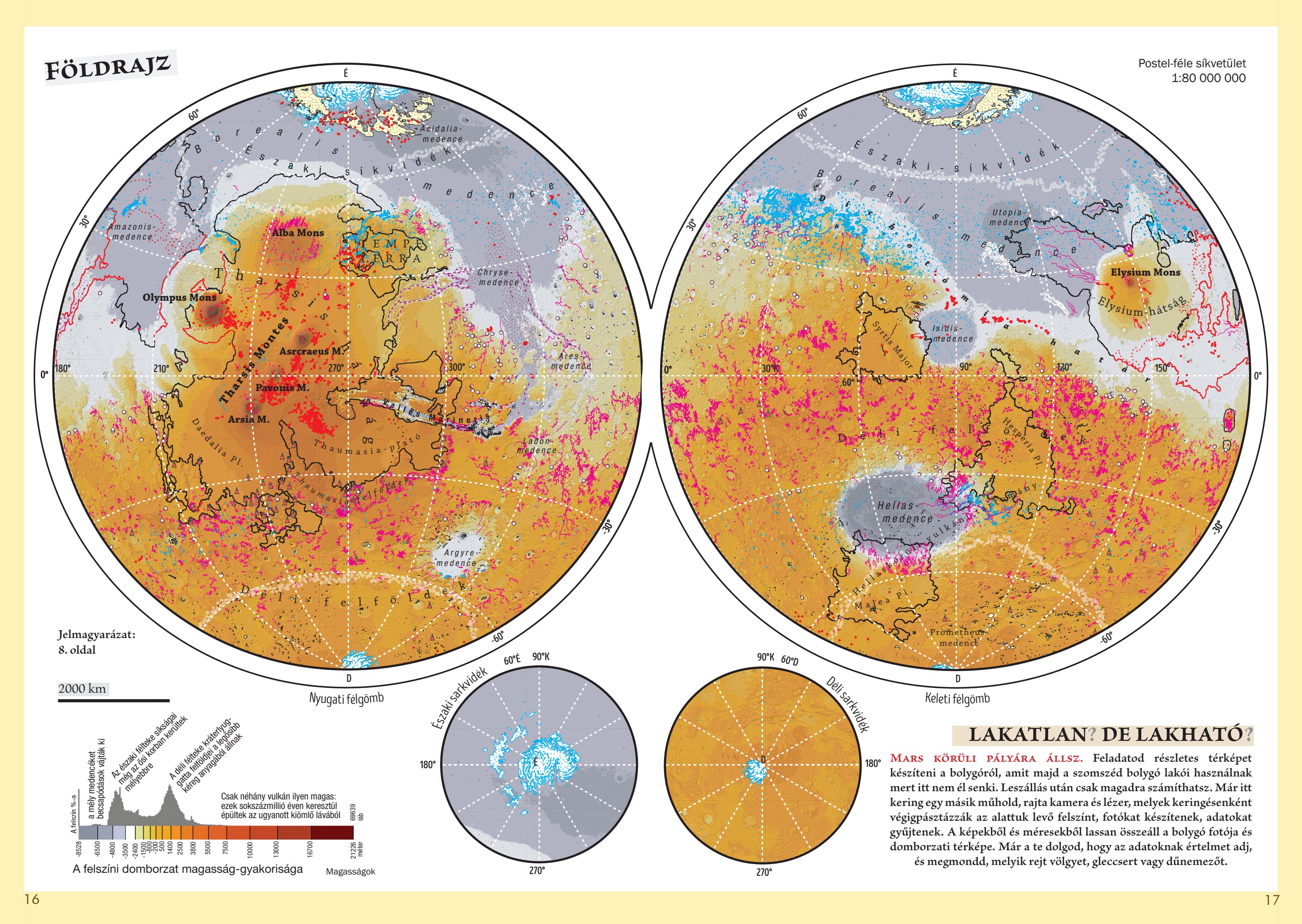
Geographical map
Zoom with the mouse wheel inside the image or use the buttons. Drag the enlarged image with the hand cursor; swipe to move on a touchscreen.
You enter orbit around Mars. Your task is to make a detailed map for the inhabitants of the neighbouring planet, because nobody lives here. After landing, you must rely on yourself. Another satellite is already in orbit, carrying a camera and laser that scan the surface below on each circuit, taking photographs and collecting data. These images and measurements gradually form a photographic and topographic map. It is now your job to make sense of the data and identify valleys, glaciers and dune fields.