
Henrik Hargitai reporting
Henrik Hargitai reporting
INTERACTIVE MAP
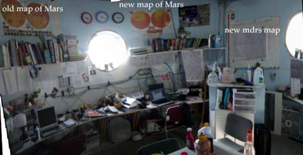
We have created an ArcMap 9 based
map of the area. It was used for printing daily EVA maps and a wall
map in the hab.
A wall map has been printed: we fixed it on the wall of the hab, just
as a new version of the topographic map of Mars which was placed on the
wall in 2006.
MAST TESTING
(Post EVA analysis)
We wanted to go to Maxwell Montes. We selected Cactus Road on the MAST
beta software. From the main road there was no arrow on the program but
we could find it in the map quadrant view. At the software we also could
not find out how to turn at the cactus rd junction - but again, clicking
to the appropriate map quadrant we could find the way. At the end of the
road we could not find which one is Maxwell Montes, since there was no
indication of North/South directions (it is W of the road).
While looking at the software images, we tried to verbalize the way:
two rocks, riverbed, xx Mountain, two rocks again, bumpy road etc., It
would be good to have such verbal hints for better memorizing the pictures.
In the field: first we took the wrong road (Chapman), which looked
very familiar at its dead end (U turn tracks). We returned to the main
road and found the good one using GPS and map. Then what I saw was that
it goes into a rock field at the foots of a rocky hill and turned back
to find the way, but Mónika told that those rocks are very familiar, the
way is in between. She was right - that was a positive indication that
the software helped finding our way. We have lost the road 3 times, since
it was crossed by or continued by unnamed roads, which clearly had car
tracks and which are indicated as dashed lines. I think we should add them
to the map and name them. After that we turned back and went home, in a
- after a while - totally unknown road, which turned out to join the main
road near Scylla and Charybdis.
EVA25 Skyline Rim
In some points it was a safe feeling that we have already seen this.
The image, however can not reflect the steepness of slopes and depths of
troughs, furrows in the way so it is difficult to estimate the danger level
of the chosen path in advance.
New (?) Unnamed roads discovered
- Road connecting Cactus Road to Chapman Way right in the longitude
line of 5200000 North-South direction. This way a complete circle can be
taken.
- Road from Cactus Road to Scylla and Charubdis. One point was taken:
520100/4249300. On the map a dashed line can be seen but it is only part
of this road.
- The point about 520000 / 42515500 on Cactus Road (near W-Candor Chasma/Unnamed
mountain) is a problematic one, since it is a hard rock surface and the
tracks can not be preserved, so the path of the road is not visible.
SUGGESTIONS FOR NAMES
- Next to Daisy and Duke we have named the 3rd hill Csilla (519702
/ 4256169), after the daughter of our crew engeneeer István Tepliczky.
- Dragonhead Rock / 0518564 / 4249193 / 1345 m One large piece of rock.
Named by Mónika Boros-Oláh / Crew 71
- The meanderins (bends) of Snake River at near 516092 / 4254762 may
be named Twilight Loop (at Mudstone Mounds): named by Tibor Hirsch, of
crew 71.
- at 0518297 / 4250829 1382 m Tribe of Extreme Blacks (Field of black
rocks 120 m from the hab) named by Ákos Kereszturi, crew geologist
- at 520109 / 4251645 there is an unnamed hill next to the road.
We have named it Submarine Battlement.
We would like this experiment to continue with the same objects, therfore we named them (between asterisks) and hope that in few year’s time it can be repeated (taking picture of the same sites from the same viewpoint).
Process of change detection
1. Image selection - interesting and easy-to-find places
2. Making image printouts and taking them with us for EVAs
3. Finding the place without exact GPS data
4. Finding the exact location (viewing angle) where the picture was
taken (in 3D space)
5. Finding the exact zoom value as in the original image
6. Taking picture through helmet (problem: the camera display is difficult
to see through the helmet during daytime, so the exact viewpoint could
not be determined this was. Theerfore, registration and transformation
of the images was needed)
7. Registering the new images to the old one (using 5-15 control points
and 2nd order polynomial transformation, using ArcMap software)
8. Making of blinking images with the use of Photoshop/Image Ready
software
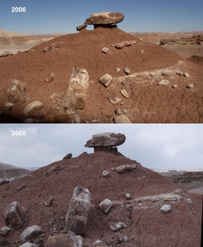
*Jason’s Rock*: (top of the hill, Toothy Ridge) a small rock which
used to be its partial support has been removed
516 956/ 4 256 062
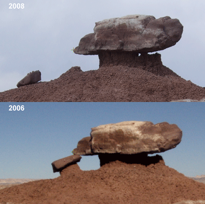
close-up
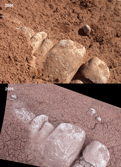
*Giant’s Toes*: one piece of rock was broken; the weathering eroded
a little more soil from the toes.
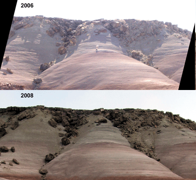
*Hill of Rockfalls*: (visible from Toothy Ridge) there is no apparent
change
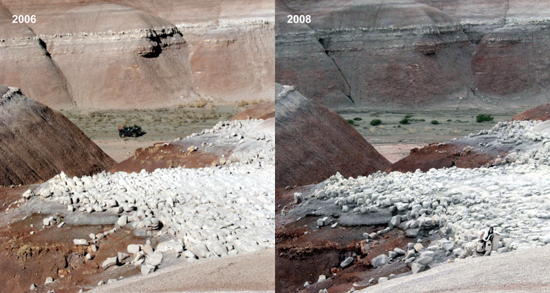
Toothy Ridge hilltop: some rocks have been fallen/flipped
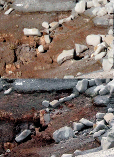
closeup:
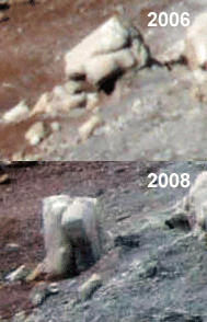
closeup
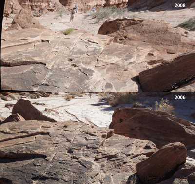
*Cracking Table* in Lith Canyon, towards T-Rex canyon: no apparent
change
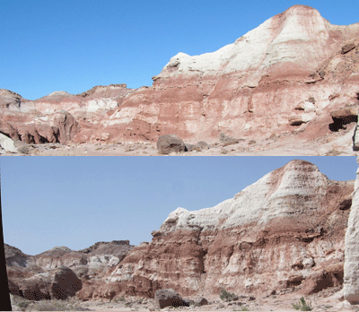
Unnamed hill in Lith Canyon: no apparent change
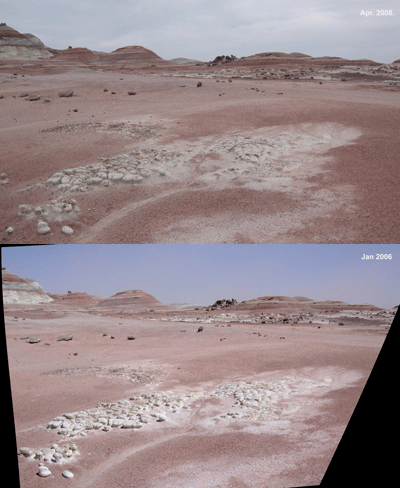
*White Mushroom Field* at 0518642/4250939/1374m:
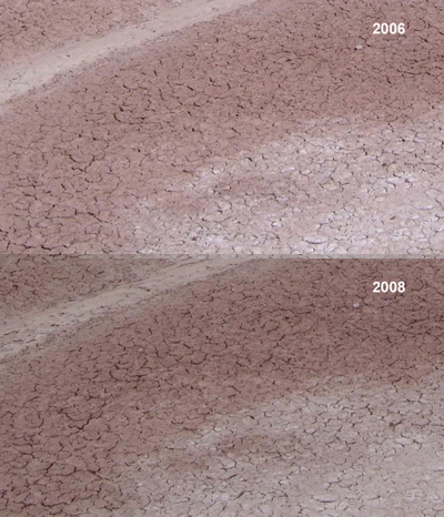
*White Mushroom Field* at 0518642/4250939/1374m:
Shrinkage cracks, and surface salt precipitation, no apparent change
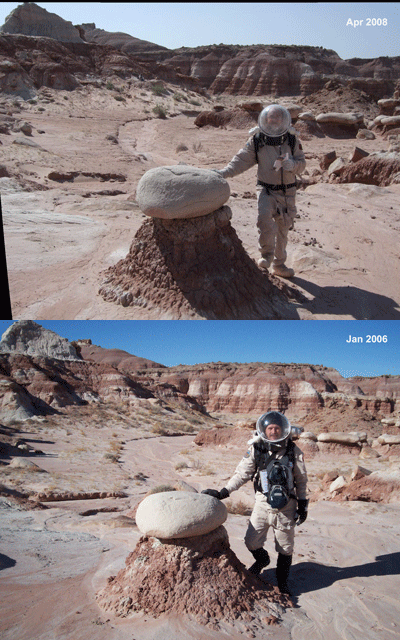
*T-Rex Egg* no apparent change (seeming changes are due to different
viewpoint), but there are changes in vegetation (less grass, more sand)
and in the course / banks of the washes
(A sub-canyon to the right in T-Rex Canyon)
518 484 / 4 256 740